montgomery county today
        
        
          51
        
        
          soil and enters cracks in the underlying bedrock.
        
        
          Soil, vegetation, topography, and land use are
        
        
          all factors that influence the recharge of
        
        
          groundwater.  Soil structure allows percolation
        
        
          of water at varying rates.
        
        
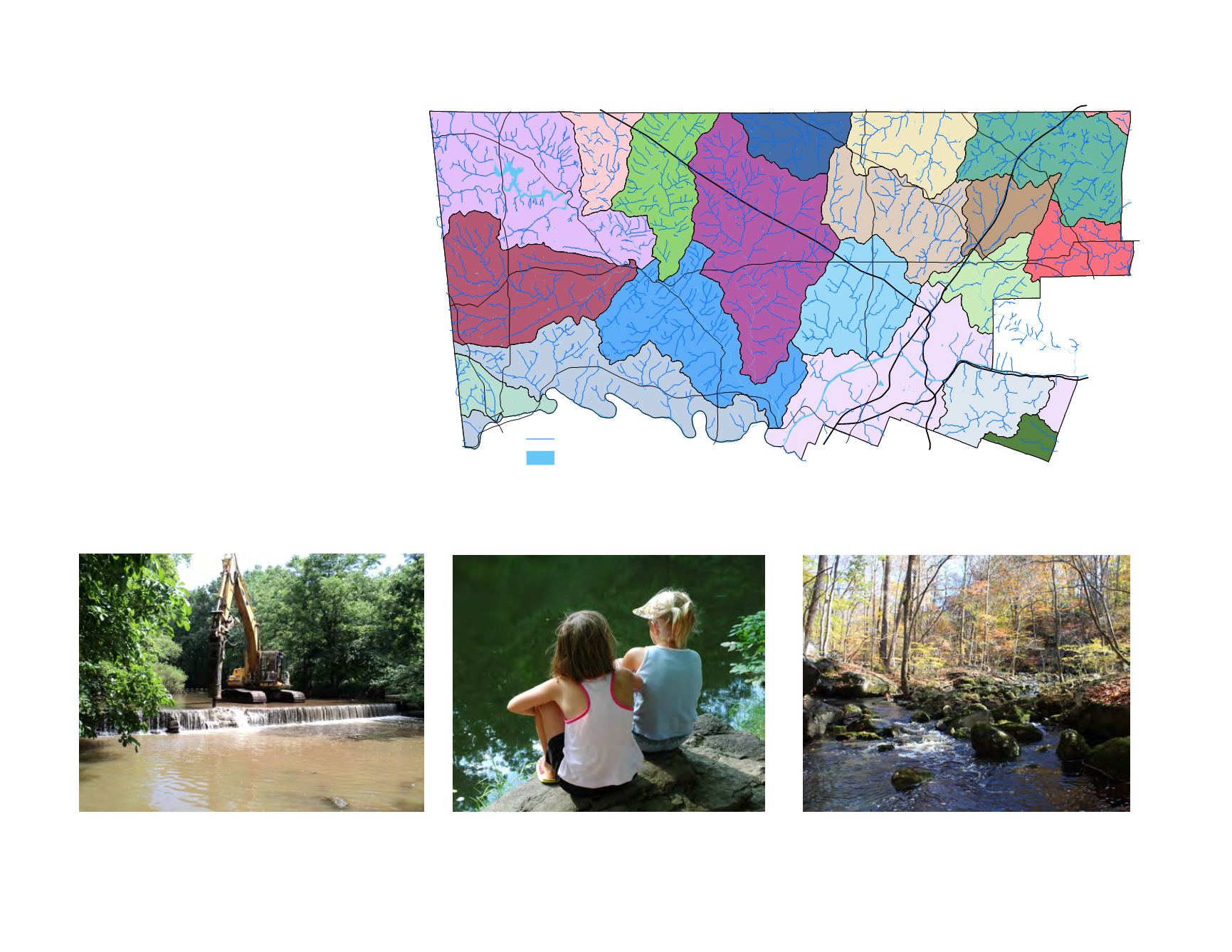
          The most visible components of the county’s
        
        
          hydrology are the numerous rivers, streams, and
        
        
          creeks that drain the landscape within
        
        
          watersheds. The major waterways include the
        
        
          Schuylkill River, Perkiomen Creek, Skippack
        
        
          Creek,  Neshaminy Creeks,  Pennypack Creek,
        
        
          the Wissahickon Creek, and Tookany Creek.
        
        
          Water quality is  impaired by point sources of
        
        
          pollution such as industrial discharges and waste
        
        
          water treatment plants and non point sources
        
        
          which may include urban stormwater, sediment,
        
        
          and agriculture waste.  Currently 48% of the
        
        
          county’s streams do not attain current water
        
        
          quality standards set by the Pennsylvania
        
        
          Department of Environmental Protection.


            FIGURE 43:


            Watersheds


            An old dam in the Wissahickon Creek is removed to improve


            water quality and fish habitat.


            A stream can be attractive to people of  all ages.


            The Ridge Valley Creek flows through Salford Township.


            Source: U.S. Geological Survey


          Skippack
        
        
          Swamp
        
        
          Pennypack
        
        
          Upper Perkiomen
        
        
          Lower Schuylkill
        
        
          Upper Schuylkill
        
        
          Lower Perkiomen
        
        
          Tookany
        
        
          Upper Wissahickon
        
        
          Neshaminy
        
        
          Sandy Run
        
        
          Little Neshaminy
        
        
          Stony Creek/Saw Mill Run
        
        
          Manatawny
        
        
          Lower Wissahickon
        
        
          Lower Merion DrainageArea
        
        
          East Branch of the Perkiomen
        
        
          Unami/Ridge Valley
        
        
          Indian Creek
        
        
          Lower Schuylkill
        
        
          Upper Schuylkill
        
        
          Poquessing
        
        
          Water Bodies
        
        
          Streams
        
        
          ¯